
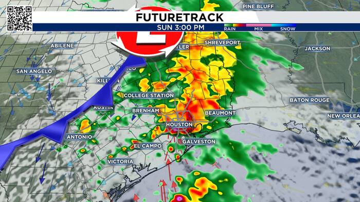
We have an important weekend forecast, and I want to walk you through what we’re going to see. Let’s start with the timing for Saturday. I think most of the day looks pretty good.
9:00 AM There’s a few showers in our western cities. As we head toward the afternoon, light rain may fall in Houston. It’s heavier off to the southwest at 4:00 PM. It will be hit and miss for the rest of the evening. The rain won’t bee too impactful but it will be a nuisance if you are trying to do something outside.

As people are starting their Sunday, you could see some scattered rain in the Houston area. The strongest thunderstorms are north of southeast Texas.

Widespread heavy rain moves into Houston Sunday afternoon. There are some severe weather parameters that are coming together, and if they can line up, we could get severe weather at this time. Make sure you have a back up plan Sunday afternoon and night.

While the threat is low, hail, damaging winds and a tornado are possible. Our far northern and northeastern cities do not have as much energy in the atmosphere for strong storms. The rest of us in green are under a low threat.

From The Woodlands south, flooding for low-lying areas and areas with poor drainage, as well as minor street flooding is possible.

The graphic does a good job of showing the range in rain totals through Sunday. If too much rain falls in a short amount of time, we’ll get flooding.

By the time we get to 10:00, the storms are off the coast and a colder and windy day arrives Monday. Be safe and if you get any good pictures of the storms please send them to www.click2pins.com.


