
On Tuesday I shared what El Niño is and how it typically affects Texas. If you haven’t read it, click below.
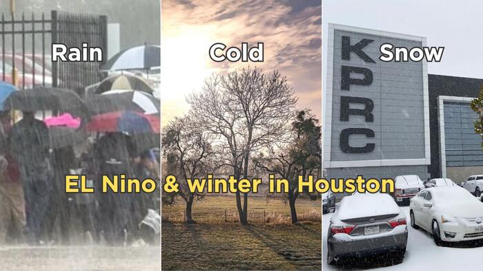
There is a strong historical connection between El Niño and Houston’s winter weather. From December through February, Southeast Texas typically sees cooler-than-average temperatures and above-average rainfall.
Looking back to 1950, when El Niño began being monitored, 71% of Houston winters during El Niño years were colder than average. Even more impressive, 77% were wetter than average.
That’s a pretty strong correlation! But keep in mind, these numbers include El Niño events of varying strengths. What happens when we look at the strongest ones?

This is the latest El Niño update, and it’s still possible this event could become the strongest ever recorded.

Here’s where things get interesting. When we look at the three strongest El Niño events of 1982/83, 1997/98 and 2015/16, we see a remarkably similar pattern. Roughly a 70/30 split, with most winters trending colder and wetter than average.
But each event had its own personality.
The winter of 1982/83 was exceptionally cold. In Houston’s 137 years of weather records, it ranks as the 25th-coldest winter.
The 1997/98 event was exceptionally wet. It ranks as Houston’s 17th-wettest winter, putting it among the wettest 10% on record.
So, historically, strong El Niño events have been pretty good indicators of a cold and wet winter in Southeast Texas.

If you’re someone who really follows the weather, you probably remember something called “The Blob” back in 2015.
It was an unusually large area of exceptionally warm ocean water off the West Coast of Canada and the United States. You can see it in the deep red colors below.
That warm water influenced the jet stream and the way storms traveled across North America. It helped steer significant rainfall and atmospheric rivers toward western Canada rather than delivering the typical winter pattern farther south.
That was one of the biggest reasons the winter of 2015/16 didn’t follow the same script as the other major El Niño events.
Could something similar happen this year? Absolutely. That’s one of the challenges of making a seasonal forecast. Even when the larger climate signals point in one direction, other factors can change the outcome. I often say I’m giving you a forecast, not making a promise. Seasonal forecasts are especially challenging because we’re looking months into the future.
That said, the signals I’m watching are pointing toward a colder-than-average and wetter-than-average winter for Houston.

Let’s start with December:
The long-range outlooks are lining up with what we would typically expect during El Niño.
Below is the 30-day forecast from the European model. The blue shading over Texas indicates temperatures are expected to be below normal.

December should be the beginning of a stretch of colder-than-average months for Southeast Texas.
In addition to El Niño, we’re watching an atmospheric phenomenon called stratospheric warming. This involves a rapid warming of the stratosphere, which can disrupt the polar vortex and help send colder Arctic air farther south.
There is also the potential for another stratospheric warming event in January, which could help bring additional cold air into Texas during February.
Another interesting factor: This year’s El Niño is peaking much earlier than the 1982/83 event.
Of course, that doesn’t mean every day in December will be cold. We’ll still have our share of warmer days. But when you average everything out, I’m expecting a colder-than-average month with above-average precipitation.

By the time we get to the end of February, I think there’s a good chance we’ll be looking back at a winter that was both colder and wetter than average.
For those of us in Houston who rarely get much use out of our winter coats, you may want to keep them handy. I think you’ll be reaching for them more often this year.
And don’t put away the umbrella. It certainly won’t rain every day, but I expect rain chances to be a recurring feature in our 10-day forecasts throughout the winter.
Most meteorologists will tell you that making a snow forecast for Houston this far in advance is a little like throwing a dart at a moving target.
But I recently talked with my friend and fellow meteorologist Joe Bastardi of WeatherBell, a private forecasting company. He’s willing to take that gamble!
Joe is forecasting 1.5 inches of snow for Houston this winter!
And he’s not stopping with Houston. Joe thinks parts of the I-10 corridor, from San Antonio eastward toward Jacksonville, Florida, could see snow for the third consecutive year.
His other snowfall projections include:
The strong El Niño winter of 1997/98 even brought snow all the way down to the Rio Grande Valley.
Below is a picture of the snow that fell in January 2025. Could we see a repeat this winter? It’s certainly possible!
I’m not ready to put snow in our official forecast just yet, but it’s something worth watching as we get deeper into winter.

The story doesn’t end with winter:
One of my bigger concerns is what happens when this El Niño eventually breaks down, which could happen sometime between March and April.
A transition out of El Niño can bring significant changes to the jet stream and overall weather pattern. Depending on how that transition unfolds, we could see a setup that favors more severe weather across Houston and Southeast Texas next spring.
And there’s another reason to keep watching: Next hurricane season should be an active one.
We’ll have plenty of time to dig into that as we get closer, but the bottom line is that this El Niño could have implications well beyond the winter months.
For now, get those winter coats ready, keep the umbrella handy, and don’t completely rule out the possibility of seeing a few snowflakes in Houston!


